Key Advantages
Your Private Cloud Platform for Intelligent Satellite Monitoring
-

Global Satellites
Integrates Global Satellite Data
Access premier data sources with millions of historical images. Enables efficient global monitoring and retrieval of historical spatial data for key organizational projects.
-

Custom Subscription
Daily Fresh Imagery, Automated Delivery
Thousands of updated scenes daily, featuring high-resolution satellite imagery. Seamlessly integrates and manages drone data to fully support your organization's digital transformation with reliable, up-to-date spatial intelligence.
-

Targeted Query
Business Monitoring, Live, Automated
Interactively discover and compare vast historical imagery by location or area. Gain real-time awareness of spatial changes from orbit with multi-temporal analysis at your fingertips.
-

AI-Powered Monitoring
Robust Data Intelligence
Seamlessly load business models and AI algorithms with real-time data sources. Publish results instantly and enable real-time collaboration across your organization.
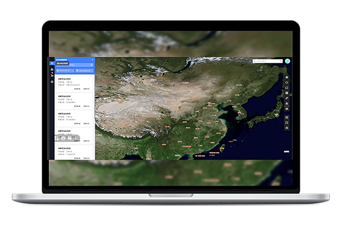
Subscribe & Access Fresh, Multi-Source, High-Res Satellite Imagery
Your Private Virtual Constellation
Integrates global satellite sources to build your customized remote sensing platform, delivering all-weather, global, multi-factor monitoring.Project-Based Self-Service
Subscribe to latest imagery by project area with thumbnail previews and online ordering—seamlessly integrated with organizational procurement.Daily Updated High-Res Data
Thousands of new scenes daily with sub-meter to meter resolutions. Includes rapid drone image correction for enhanced clarity and timeliness.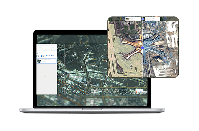
Search with Precision, Compare with Ease
Massive Data, Instant Access
Instantly search and filter from millions of historical images with location-based lookup for any address or area.Interactive Analysis, Intelligent Insight
Use map-based selection for spatiotemporal queries, view imagery at full resolution, and compare multi-temporal scenes side-by-side. Seamlessly integrate AI models to extract actionable insights —all from your desk.Mark & Measure Tools
Annotate, draw, and measure directly on imagery for practical analysis and planning.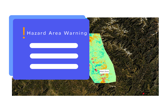
Auto-Monitoring, Shared & Collaborative
Automated Monitoring
Integrate live imagery with algorithms for instant result publishing and server-based automated monitoring applications.Real-Time Collaboration
Enable cross-department teamwork with dynamic data processing and algorithm integration for shared operational goals.Seamless Multi-Platform Support
Built with advanced engine technology offering standard APIs and rapid data access for smooth visualization on mobile, desktop, and large screens.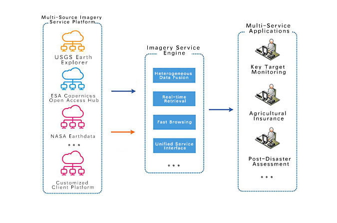
Your Spatiotemporal Data Hub
Centralized & easy management of multi-source data — satellite, drone, online/offline imagery, all-stage results, and business data — all under one unified platform. Web-simple operation, shared across your organization.
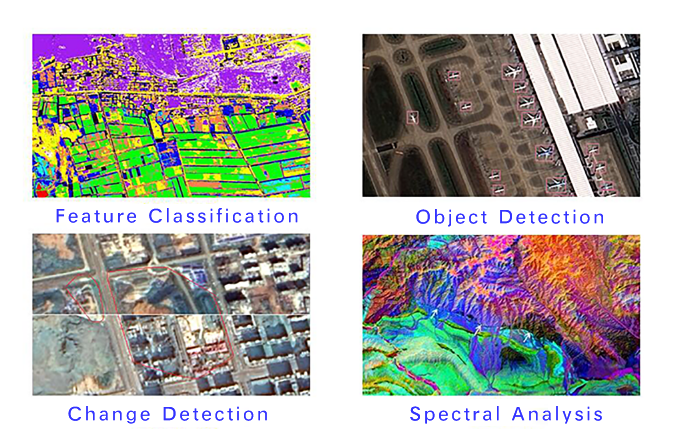
AI Change Detection & Feature Recognition – Sense Spatial Shifts Intelligently
Powered by Data Easy's built-in algorithm library, the platform offers over 30 pre-integrated functions—including image mosaicing, color normalization, change detection, land cover classification, and object identification—ready for immediate use. It also enables organizations to train and deploy custom models, helping enterprise users gain AI-driven insights into environmental changes and build scalable capabilities for spatial analysis, statistics, and quantification.
Application Scenarios
Insurance & Finance
Crop Monitoring
Energy Infrastructure

Insurance companies leverage massive remote sensing imagery to efficiently monitor large-scale assets—such as projects, buildings, and farmland—in real time with extensive coverage. By integrating historical and current spatial data, they significantly reduce risk costs and accelerate digital transformation. Financial and futures institutions also use these capabilities to track and monitor key terrestrial assets.
- Online subscription and multi-temporal analysis of insured assets
- Seamless integration and standardized management of policy data with multi-source satellite imagery
- Real-time spatial information retrieval and risk assessment by location/address
- Authoritative spatiotemporal data support for claim disputes
- Continuous tracking of key assets for financial and futures applications
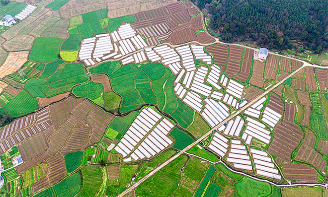
Agricultural enterprises and organizations utilize integrated satellite and drone remote sensing with real-time NDVI computation for large-scale, high-frequency field monitoring. The platform provides automated access to multi-source imagery, AI-powered analysis, and instant publishing—enabling dynamic crop assessment, historical data retrieval, and cross-department data sharing through a unified geospatial system.
- Real-time NDVI computation and dynamic crop health analysis
- Automated processing of multi-source satellite and drone imagery
- Unified geospatial platform for organizational data sharing

Energy enterprises leverage integrated satellite monitoring – including SAR capabilities – for high-frequency observation of offshore platforms, pipelines, storage tanks, and terminals. This enables operational safety assurance and strategic oversight of critical assets through seamless integration of custom applications into operational workflows.
- Subscription-based access to multi-source satellite imagery with real-time data publishing
- Instant retrieval and multi-temporal comparison across millions of archived scenes
- Real-time image processing integrated with AI-driven models for organizational intelligence sharing
Ready to Get Started?
Our solution consultant will contact you within 1 business day
Or call our service hotline
+86 512 6726 6068 / +86 181 3696 0617