What is Data Easy Enterprise GeoData Hub?
One GeoData Hub, Endless Intelligent Applications
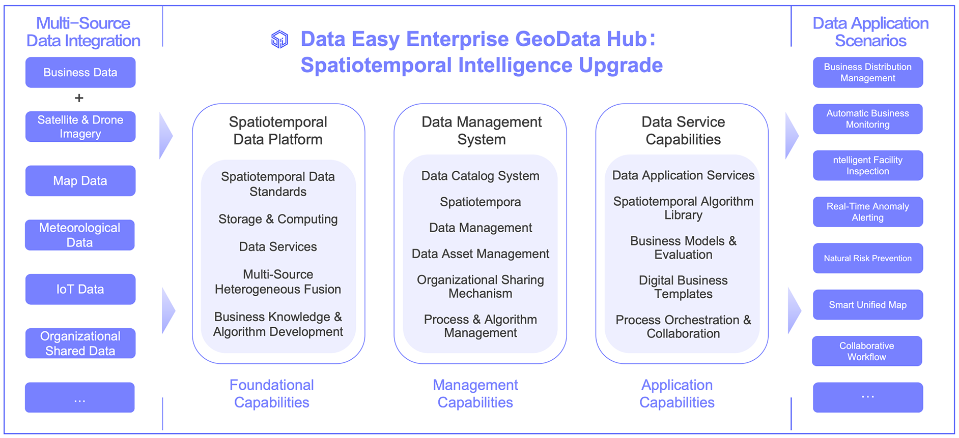
This platform integrate operational and geospatial data to reactivate organizational assets and embed business expertise into intelligent models. This creates automated workflows that boost service quality, cut costs, and enable intelligent operational evolution.
Key Advantages
Unified Data Hub: Grow Smarter
-

Automated Data Pipeline
Spatiotemporal and Operational Data Fusion
Our automated pipeline standardizes multi-source data and integrates spatiotemporal information with operational systems. This upgrades your digital mid-end platform with unified data specifications and cross-department resource sharing.
-

AI-Enhanced Spatiotemporal Modeling
Real-Time Risk Intelligence
Seamlessly connect satellite, drone, and weather data with business models and AI algorithms. Data efficiency drives operational performance—enabling intelligent risk insight and efficient management in digital space.
-

Extreme Resilience & Elastic Scaling
High-Concurrency Alerting
High-stability parallel computing supports rapid business growth, delivering millions of concurrent minute-level alerts for natural risk zones. Daily updates include 10M+ operational records and billions of weather grid points.
-

Enhanced Security Framework
Organization-Standard Compliance
Build a standardized spatiotemporal platform that meets organizational data specifications while enhancing security. This foundational system ensures stable operation and seamless integration with existing platforms and IT environments.
Natural Disaster Risk Intelligence System for Enterprises
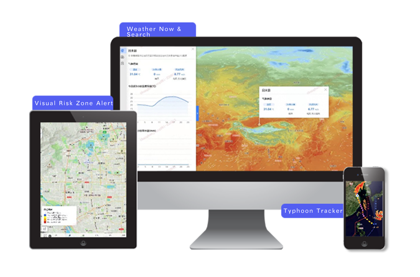
A solution-level intelligent application system focused on risk control in agriculture, insurance, emergency and other fields, providing visual weather real-time and forecasting, natural disaster prediction and early warning, capable of tracking potential severe weather such as typhoons and heavy rains.
- Provide multiple types of model data, can overlay massive targets such as farmland, buildings, forest land, etc.
- More than 10 types of gridded meteorological dynamic views
- High-precision meteorological grid data, high-precision early warning
- Multiple natural disaster models, high-stability parallel computing
Energy Pipeline Monitoring & Intelligence System
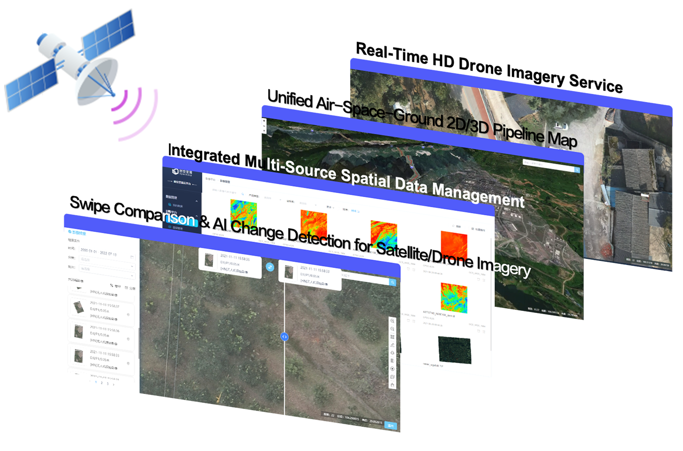
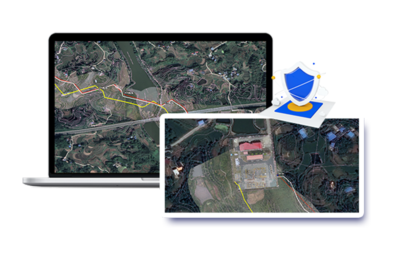
For key business infrastructure such as pipelines, provides a spatial intelligent inspection system based on (satellite, drone) remote sensing imagery, with 2D-3D high-definition perspectives penetrating spatial environments difficult for manual inspection to reach, automatically identifying pipeline anomalies and violations along the route through AI algorithms such as change detection and dynamic target detection, building spatiotemporal digital guarantee for pipeline safety and efficient operation.
- Intelligent Inspection Spatiotemporal Digital Middle Platform
- Air-Space-Ground High-definition 2D-3D Pipeline Inspection One Map
- AI Change Detection of Pipeline Surrounding Environment
- Drone Imagery Real-time Correction, High-definition Sharing, Multi-temporal Comparison Browsing
- Extreme Disaster Early Warning, Emergency Support
Emergency Response Intelligent System
Based on satellite remote sensing, drone technology, emergency resources, etc., forming emergency support and fusion capability construction that aggregates multi-source data, empowering users to flexibly retrieve multi-source spatiotemporal data, building command and deployment one map adapted to different emergency scenarios, providing instant spatiotemporal information, supporting efficient formulation of scientific decisions and solutions.
- Emergency Support Spatiotemporal Digital Middle Platform
- Business Surrounding Emergency Resources One Map
- Event Restoration and Impact Prediction Analysis
- Instant Customized Drone and Remote Sensing Satellite Monitoring
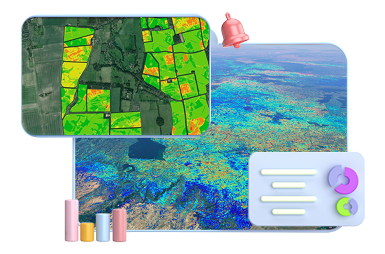
Agricultural Remote Sensing Intelligence Platform
Based on Data Easy's spatiotemporal digital platform's high-performance spatiotemporal data processing capabilities, for agricultural businesses such as natural disaster early warning, plot area management, crop management, financial credit, providing multi-source satellite and meteorological spatiotemporal data acquisition, management, processing, analysis, and application services.
- Multi-source Spatiotemporal Subscription Acquisition and Agricultural Monitoring Services
- Agricultural Remote Sensing Data Management Platform
- Massive, Multi-source Spatiotemporal Data Real-time Analysis Support
Ready to Get Started?
Our solution consultant will contact you within 1 business day
Or call our service hotline
+86 512 6726 6068 / +86 181 3696 0617