Satellite & Drone / Geospatial Surveying & Mapping
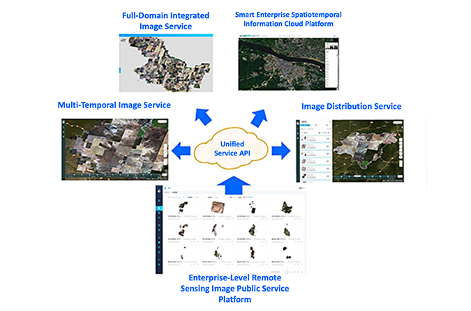
Data Easy provides a spatiotemporal foundation cloud platform for hundred PB-level, multi-source remote sensing data automated production, real-time publishing, and online processing analysis applications, helping customers build multi-level coordinated 1+N efficient comprehensive spatiotemporal data public service system and natural resources intelligent monitoring system.
- Automated data production full process with real-time publishing
- Modern data management system with "logical centralization"
- Efficient and flexible 1+N data public service system
- Highly intelligent natural resources monitoring system
Insurance & Finance
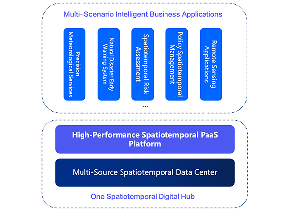
Data Easy upgrades digital middle platform with spatiotemporal informatization, establishes massive, multi-source spatiotemporal data (satellite, weather, place name address and other data) standard system and independent automated processing pipeline for customers, seamlessly integrates with business models, achieves real-time perception, precise early warning and rapid query of historical information of external spatiotemporal (ground object changes, weather, disasters), supporting real-time, automated, and intelligent policy business decision-making
- Standardized integration of professional spatial data such as satellite/weather/maps
- Natural disaster risk management based on weather and satellite data
- One spatiotemporal middle platform, real-time sharing among multiple departments of organizations
- High elasticity, dynamic scaling, enhanced security big data architecture and management system
Energy Pipeline
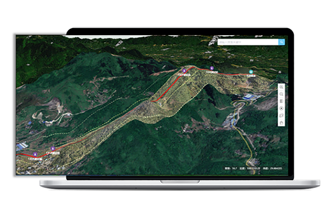
Integrates multi-source satellite (space), drone (air), IoT (ground) and other spatiotemporal data, based on Data Easy's high-performance real-time processing engine technology, provides high-resolution intelligent inspection services for energy transmission pipelines, accurately and quickly insights into energy transmission pipeline status and surrounding ground object changes, intelligently identifies pipeline safety hazards, early warns natural disaster risks, and builds a complete digital emergency management system and emergency plans.
- Intelligent inspection system based on remote sensing images, 2D-3D high-definition pipeline one map full coverage
- AI algorithm change detection, dynamic target detection, etc. automatically identify hazards along pipelines
- Integrates multi-source spatiotemporal data, rapidly predicts, identifies and alerts natural disasters and subsidence along pipelines
- Artificial intelligence dynamically collects information to judge pipeline leakage points and precisely locate them

Remote Sensing Data Science
Data Easy provides flexible real-time spatiotemporal computing framework for spatial data science, supports universities, research institutions, data scientists and business experts to embed algorithms and AI models into dynamic elastic remote sensing data processing framework, full-process real-time online dynamic processing, online collaboration.
- Remote sensing image dynamic stretching, dynamic projection, dynamic RPC correction
- Free combination of hyperspectral bands, vegetation index calculation, online updates, map information extraction, etc.
- Image super-resolution layer frontend color table real-time rendering
- Full-process automated processing of precise intelligent calling, preprocessing, personalized presentation, and model parameter calculation of image raw data

Agriculture
Data Easy build specialized spatiotemporal data infrastructure for agricultural technology enterprises, delivering automated acquisition, real-time processing, and intelligent analysis of satellite and drone imagery—providing foundational data support for digital agriculture solutions. Our platform has empowered multiple AgTech companies with reliable, continuous remote sensing data services, accelerating the transition from traditional farming to data-driven intelligence.
- Automated multi-source satellite data acquisition and standardized processing pipelines
- Real-time dynamic computing engine with 10x faster processing speeds
- Rapid geometric correction and radiometric calibration for satellite/drone imagery
- Real-time NDVI computation and vegetation index analysis services
- Cloud-integrated data management and API services
Ecology & Environment
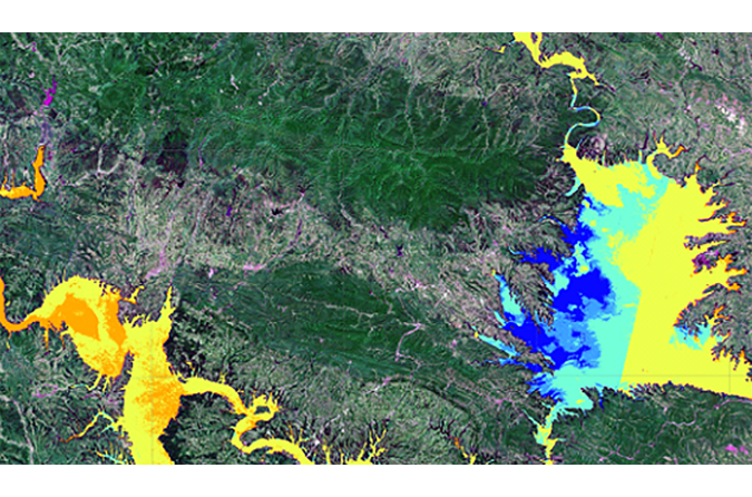
Data Easy supports watershed ecology management and water-quality monitoring with PB-scale remote sensing infrastructure, delivering real-time publishing and flexible analysis. We enable automated data preprocessing, water parameter retrieval, target identification, and thematic mapping—enhancing dynamic ecological oversight.
- Web-Native Workflow Shift from desktop to browser: real-time processing with multi-device collaboration.
- Unified Data Sharing Centralized storage and non-sliced publishing for seamless multi-user access.
- Platform + Algorithm Model End-to-end automation from data ingestion to result publishing.
- Intelligent Monitoring Automated inversion of remote sensing parameters integrated with structured data from monitoring stations.
Ready to Get Started?
Our solution consultant will contact you within 1 business day
Or call our service hotline
+86 512 6726 6068 / +86 181 3696 0617