Key Advantages
Empower Your Emergency Management: A Digital Shield for Government & Business
-

Operational Geohazard Monitoring
Customized High-Frequency Disaster Tracking
Leveraging multi-source satellite data, gridded weather and disaster datasets, this system delivers real-time alerts for terrain changes, landslides, and heavy rainfall near your assets—with prioritized monitoring of critical infrastructure and historical risk zones.
-

Emergency Resource Map
Multi-Hazard Monitoring & Response
Using dynamic spatial indexing, the platform rapidly assembles specialized maps showing emergency facilities, multi-level resource networks, and command deployment views—strengthening early warning and defensive capabilities across selected regions.
-

Event Analysis & Visualization
Compliant & Action-Ready Intelligence
Reconstruct incident scenarios, auto-generate risk levels, and predict impact areas. Deploy optimized emergency plans with full-platform support (large screen/PC/mobile) for real-time multi-stakeholder collaboration.
-

Real-Time Emergency Imagery Service
Minute-Level Processing & Sharing
Retrieve and publish multi-temporal emergency area data within 1 minute, with integrated 2D/3D full-resolution browsing. Correct and publish single satellite/drone images in 60 seconds, enabled by real-time AI analysis and one-click result distribution.
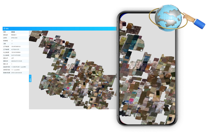
Emergency Spatial Platform: High-Performance & Scalable
Integrates, manages, and retrieves multi-source data—satellite/drone imagery, maps, POIs, cameras—aligned with operations.
Emergency Services Publish multi-temporal emergency data in 1 minute with 2D/3D full-resolution viewing.
Rapid Processing Correct and publish ~1GB satellite/drone imagery within 60 seconds.
Real-Time Analytics Integrates algorithms for intelligent image analysis and one-click publishing, including weather forecasting and hydrological/DEM analysis.
Emergency Services Publish multi-temporal emergency data in 1 minute with 2D/3D full-resolution viewing.
Rapid Processing Correct and publish ~1GB satellite/drone imagery within 60 seconds.
Real-Time Analytics Integrates algorithms for intelligent image analysis and one-click publishing, including weather forecasting and hydrological/DEM analysis.
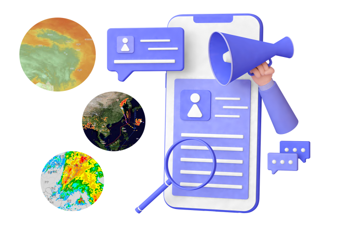
Dynamic Risk Intel
- Leveraging multi-source spatial data and AI, we deliver real-time disaster alerts and automatically generate holographic hazard maps—enabling fast, informed response for government and enterprise users.
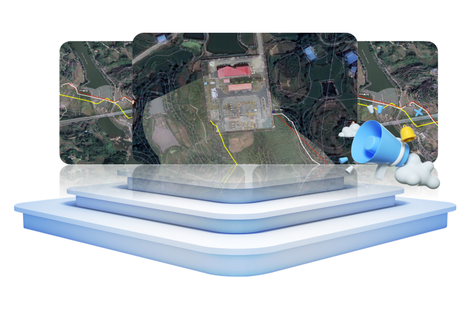
Smart Event Analysis & Resource Mapping
- In emergencies, the system rapidly gathers exact location, incident details, and environmental data like wind and temperature. It automatically builds situational models and generates impact areas, risk levels, and response plans through spatial analysis.
- The platform intelligently pushes multi-dimensional emergency resource data nearby, enabling multi-level coordination and real-time resource visibility. This strengthens prediction, prevention, and response capabilities while accelerating emergency deployment.
Application Scenarios
Emergency Intelligence
Agricultural
Urban Emergency

A unified platform enabling cross-department coordination through real-time multi-source data integration, dynamic disaster tracking, and intelligent visualization. Delivers rapid warnings for typhoons, floods, land subsidence, and landslides while supporting multi-screen command operations with synchronized emergency resource deployment.
- Integrate and share real-time spatiotemporal data across agencies.
- Enable rapid alerts and dynamic monitoring for multiple disaster types
- Deliver interactive visualization of hazards and impacts on a unified map
- Support multi-platform command screens with live emergency coordination

Agricultural organizations automate access to multi-source satellite imagery and AI models, delivering real-time crop insights and historical spatial data through location-based search. Enables multi-department weather data sharing and dynamic risk visualization.
- Unified weather map showing crop-field disaster relationships
- Centralized platform for cross-department meteorological data sharing
- Dynamic visualization of multi-type weather impacts
- Historical risk zone analysis with prioritized protection

Energy, emergency response, and meteorological agencies coordinate through precision weather systems that enhance prediction accuracy and disaster prevention. Establishes spatiotemporal data-driven response mechanisms for extreme weather scenarios.
- Weather disaster planning using precise forecasting
- Grid-based refined management for emergency response
- Targeted monitoring of historical risk zones
Ready to Get Started?
Our solution consultant will contact you within 1 business day
Or call our service hotline
+86 512 6726 6068 / +86 181 3696 0617