The Challenge
Energy Pipeline Safety: Critical Infrastructure Protection
Natural gas pipelines—long-distance, high-pressure, and high-volume—present substantial risks. Traditional manual inspections are costly and inefficient, while conventional digital systems offer limited planar views, lacking comprehensive spatial monitoring. With extreme weather increasing, energy providers must integrate diverse spatial data to strengthen response mechanisms and improve disaster forecasting and prevention.
-

Pipeline Threats: Third-Party Damage
Rapid urban development has increased construction along pipelines—including drilling, excavation, and blasting—raising the risk of incidents.
-

Geologic Risks: Terrain & Climate
Long-distance pipelines cross varied terrain where earthquakes, landslides, and heavy rainfall can cause significant damage.
-

Inspection Gaps: Slow Data Flow
Manual inspections are inefficient and fail to cover all areas due to terrain constraints. Traditional systems only provide basic reports without real spatial monitoring, while drone data processing remains too slow for high-frequency precision inspections.
Data Easy Solution
Integrated Air-Space-Ground Pipeline Monitoring & Emergency Platform
Data Easy's automated spatiotemporal platform processes drone, satellite, and weather data with AI vision models to build an intelligent digital hub for energy operators. This integrated system enables low-cost, comprehensive, and high-precision pipeline monitoring—combining routine inspection with real-time map-based emergency coordination to ensure safe and stable operations.Advantages
-
Unified Pipeline Map
Integrates drone, satellite, map, IoT, and camera data into a single 2D/3D high-definition view. Switch perspectives seamlessly to access hard-to-reach areas and maintain both broad oversight and precise operations.
-

Smart Inspection Service
Offers complete drone route planning, 5cm HD image processing, real-time sharing, multi-temporal comparison, and AI change detection. Streamlined, high-frequency inspections made simple.
-
Hazard Alert Map
Monitors terrain shifts, landslides, and heavy rainfall in real time. Detect pipeline risks early for proactive maintenance and prevention.
-
Emergency Response Map
Visualize incident scenarios, assess risk levels, and locate nearby resources. Supports data-driven decisions and optimal deployment of emergency measures.
Scenarios & Cases
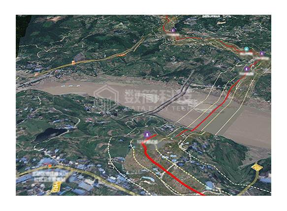
Integrated Air, Space & Ground Pipeline Monitoring
Data Easy's intelligent platform fuses multi-source satellite, drone and IoT data to deliver comprehensive pipeline integrity management for leading energy operators. Our solution enables real-time anomaly detection, threat identification and natural hazard monitoring—boosting operational efficiency tenfold while cutting operational costs by 70% through automated, precision pipeline management.
- Enable persistent surveillance with systematic inspection cycles
- Deliver integrated 2D/3D pipeline visualization with full coverage
- Provide real-time 5cm drone orthorectification and instant viewing
- Unify operational data through spatial intelligence dashboards
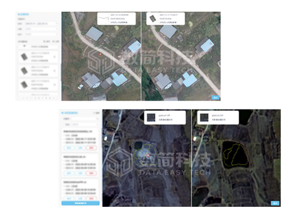
Intelligent Detection of Spatiotemporal Changes & Human Threats Along Pipelines
Leveraging multi-temporal drone and satellite imagery with swipe comparison and AI change detection models, our system delivers highly accurate and efficient identification of human interference and safety risks near pipelines.
- Automatic third-party activity detection with closed-loop management
- Intelligent identification of natural disasters, human activities, and structural risks
- Pipeline leak detection and safety hazard monitoring
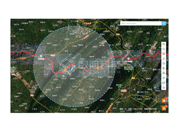
Disaster Intelligence & Response Platform
Data Easy's pipeline monitoring system evolves into a comprehensive emergency management platform, integrating vector maps, infrastructure data, weather inputs, and geological hazard models into a unified operational view. Through dynamic data fusion and spatial analysis, it enables real-time risk alerts, incident assessment, and optimized response deployment—strengthening organizational emergency preparedness.
- Build emergency scenarios with spatiotemporal simulation
- Automatically identify and dispatch nearby response resources
- Generate personalized emergency plans
- Enable multi-department coordination through shared situational awareness
Get Energy Pipeline Field Spatiotemporal Solution Now
Welcome to call our service hotline
+86 512 6726 6068 / +86 181 3696 0617
or mail us
sales@shujiantech.com