Introduction
Satellite and UAV-collected data are often large in scale, not only occupying significant storage resources but also requiring high-end computer configurations for processing. Traditionally, when organizations adopt cloud-based multi-user data sharing, data must undergo tiling and publishing before subsequent analysis and computation can begin. So, how can organizations both share large-scale satellite remote sensing image data and perform rapid data analysis and computation efficiently?
This article introduces an integrated real-time model for cloud-based sharing management, dynamic processing, and second-level full-resolution browsing of processing results for GB-scale satellite (and UAV) images. Powered by the Data Easy Spatiotemporal Data Platform, users can create a dedicated data cloud drive to quickly access massive satellite/UAV remote sensing data stored in it. Meanwhile, the platform supports real-time dynamic processing functions such as coordinate projection conversion, linear stretching, band mapping, and NDVI calculation—with no waiting time for full-resolution browsing of processed results. It delivers a simple and convenient experience for surveying and mapping departments, satellite and geoinformation centers, earth sciences, and natural resources remote sensing monitoring, driving business value.
01 Platform Overview
The Remote Sensing Data Platform within the Data Easy Spatiotemporal Data Platform is an independently developed, end-to-end real-time, automated, and intelligent processing platform specifically designed for massive, multi-source satellite and UAV remote sensing images. It enables core functions including management, publishing, processing, analysis, query, browsing, and application of mainstream domestic and international satellite remote sensing and UAV images. When used in conjunction with vector, streaming, and other foundation platforms, it can build comprehensive management and rapid fusion applications for multi-source heterogeneous spatiotemporal data.
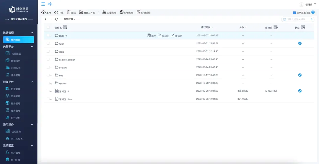
Data Easy Spatiotemporal Data Platform Management Interface
02 Create a User-Specific Data Space – Unified Cloud-Drive-Style Management
The platform allows each user to create a dedicated data space. Users can directly access their data management interface via a link.
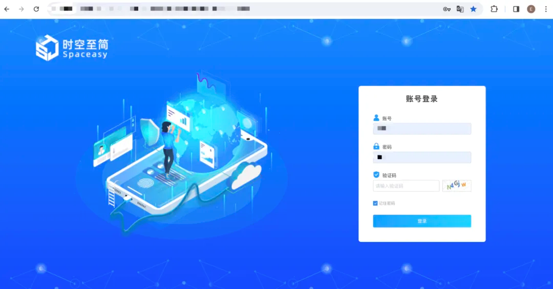
Data Easy Spatiotemporal Data Platform Login Interface – Enter username, password, and verification code to access the dedicated remote sensing image cloud space
This is equivalent to creating your own remote sensing image "Dropbox" or “iCloud”—simply log in with your credentials via a single link to get started.
Within the "My Data" section, users can upload, download, move, and extract data. Data required for the same project or regularly updated data can be stored in a single folder for easy management. Additionally, users can instantly browse data, rename files, and view various data attribute information.
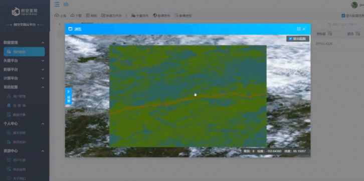
Full-resolution online browsing of data directly within the platform
03 Convenient Cloud-Drive-Style Operations – Flexible Multi-Method Data & File Synchronization
We've all used Dropbox—its seamless automatic synchronization of photos, videos, and other files between mobile devices and the cloud not only saves storage space on phones and computers but also enables anytime access and sharing. But how can we conveniently synchronize and manage ultra-large-scale professional data and files like satellite/UAV images (just like using a cloud drive) and share them with colleagues within the organization, department, or project team?
The Data Easy Platform supports enterprise and organizational intranets, private clouds, and public clouds. In this case, we created a dedicated private cloud drive via a web server, which maintains flexible two-way synchronization with all data, files, and directories in the "My Data" section of the platform.
This dedicated data space can be either user-exclusive or shared with departmental or project team members. In team sharing scenarios, each user's data space remains independent while supporting online collaboration on data-related functions.
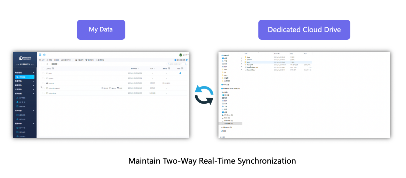
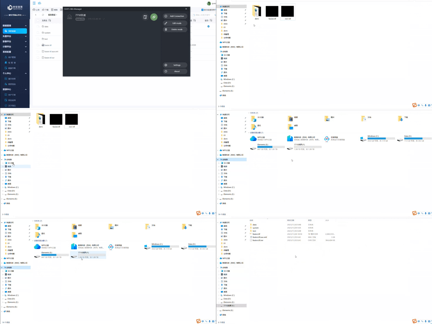
Dedicated cloud drive created via web server – Data, files, and corresponding content in "My Data" are automatically synchronized to the cloud drive
What's more convenient: almost all basic operations—such as uploading new data, moving files, or packaging and uploading folders—whether performed in the platform's "My Data" section or the dedicated cloud drive, trigger real-time synchronization between the two. No duplicate organization is required.
04 GB-Scale Images: No Publishing Required, Instant Processing, Full-Resolution Display
We've already uploaded the required data to the cloud drive (no longer taking up precious computer storage space)—now let's try accessing one of the satellite datasets and processing it as needed.
Select a 2.75GB GF-1 satellite remote sensing image from "My Data" and click the "Browse" button on the right side of the data entry to get an intuitive view of the data.
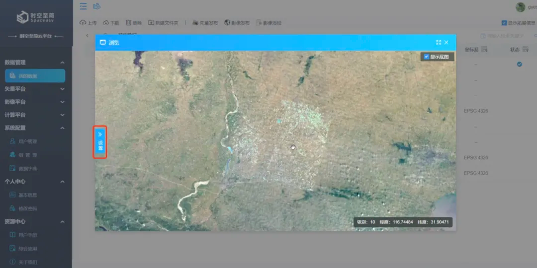
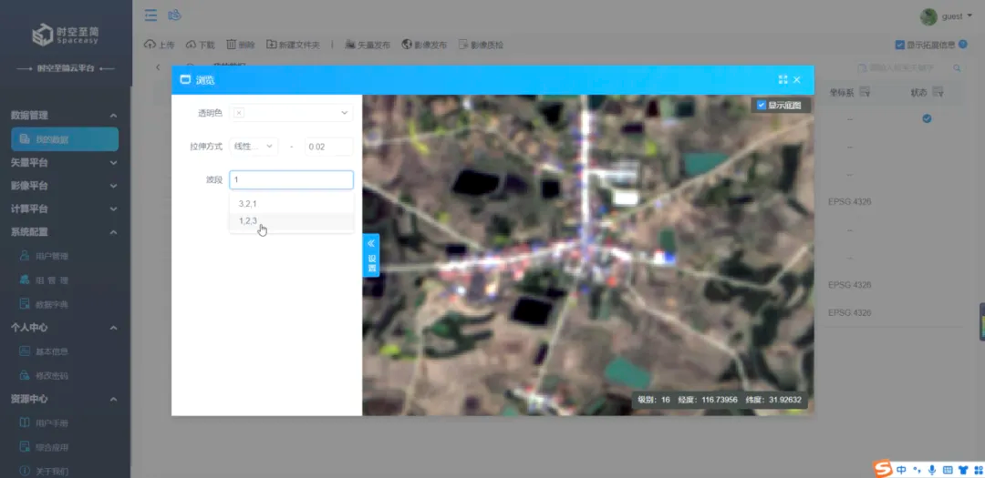
As shown, there's a vertical "Settings" button on the left side of the data window. Here, simple configurations allow for data stretching and band mapping to highlight specific ground object features, preparing for subsequent extraction.
Let's perform linear stretching on this 2.75GB dataset—no waiting required:
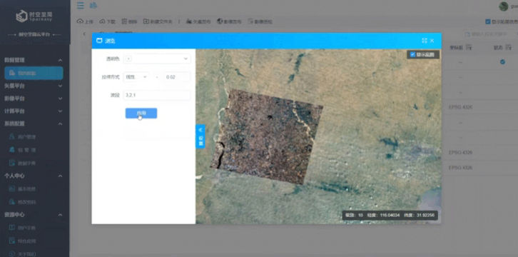
Next, apply [4,3,1] band mapping—again, the result is displayed instantly with smooth full-resolution browsing:
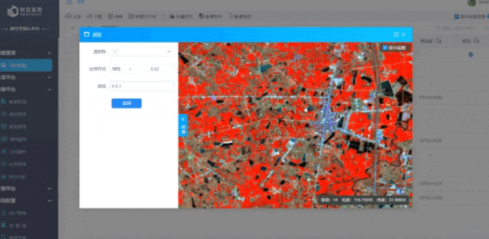
Notably, the platform's model of online dynamic processing and personalized presentation of the same original data not only saves users time on data processing but also avoids redundant data generated by multiple copies of the same dataset for different projects—significantly reducing storage costs.